
In an effort to enhance the world’s knowledge of Starlink as well as help its customers, the company has an official website where it has uploaded a real-time world map of Starlink satellites.
Younger generations have bigger brains. But is this a good thing? The dots you see will continue to grow in the coming years, as the service aims to launch new satellites almost every week, aiming to provide all users worldwide with high-speed internet.
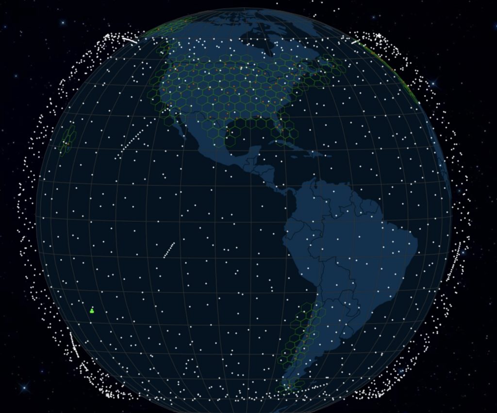
By clicking on this interactive map, you can find a lot of information about their orbit, knowing if the particular satellite will pass over it. They can select any point on the planet, giving absolute control over the tracking of Starlink satellites. tips! As we wrote in our previous article, if you have reached your limits and you are not covered by networks then Starlink is a one way.
Equipment rental costs 15 euros per month, without having to pay the full cost of the equipment, which is 225 euros up front, and 40 euros in fixed costs. You can find it here
0 Comments