
A project funded by the European Space Agency (ESA) has allowed researchers to simulate terrestrial disasters in unprecedented detail. The model is referred to as Earth’s “digital twin” and is expected to facilitate simulations of scenarios related to our planet’s impressive water cycle.
As you know, the oceans cover an incredibly large part of the earth’s surface and play an important role in the weather we experience. But the reverse is also true. The more dams we build, the more carbon dioxide we emit, and the more groundwater we pump for major purposes like agriculture, the more the Earth’s water cycle will have to readjust. Understanding the implications of these adjustments can be difficult because of the sheer volume of water we have to work with.
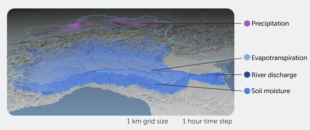
The digital twin of the Earth was created by research institutions in Italy. The beginning was made with the Po, the longest river in Italy. Thanks to its 141 tributaries, the Po is prone to flooding – a risk that must be controlled by levees over more than half its length. The researchers used the Earth’s digital twin to model the Po’s potential floods, landslides and irrigation water management problems. Based on the numerous performance scales (which they calibrated using river discharge data), the model appeared to be quite accurate, even when the researchers manipulated their simulation down to the level of each individual day.
From the Po, the group expanded to other areas of the Mediterranean basin. They hope to eventually cover all of Europe and then the entire world. As they go, they will continue to improve the model using local water cycle data.
0 Comments